Dear SIYI Technology Users,
Thank you for your continued support and trust!
In September 2024, SIYI Technology officially launched the UniGCS ground station software. Compatible with the Mavlink products, SIYI and third-party commercial ecosystem products. It features an optimized UI and operational logic, adopting a smartphone-like control interface to make industrial-grade drones and intelligent robots control simpler and smarter. During this year, we have collected a vast amount of user feedback and suggestions.
Now, the UniGCS Version 2.0 is officially here! This update introduces over ten key new features, including dual-mode RTK and five major smart routes, enabling a superior industrial-grade control experience.
UniGCS Ground Station Software |
Software Version: 2.0.3 |
Update Details: 1. Support conventional RTK & network RTK.
2. Added the oblique photography route.
3. Added the corridor route.
4. Added the bevel route.
5. Added terrain-following function.
6. Added import/export route and cloud flight route function.
7. Added route information estimation function.
8. Added route progress display function.
9. Added voice broadcast function.
10. Added resume mission from waypoint function.
11. Added point-to-point flight function.
12. Added ESC/CAN devices status information display.
13. Optimized route flight logic. 14. Fixed other known issues. |
01. Dual-Mode RTK
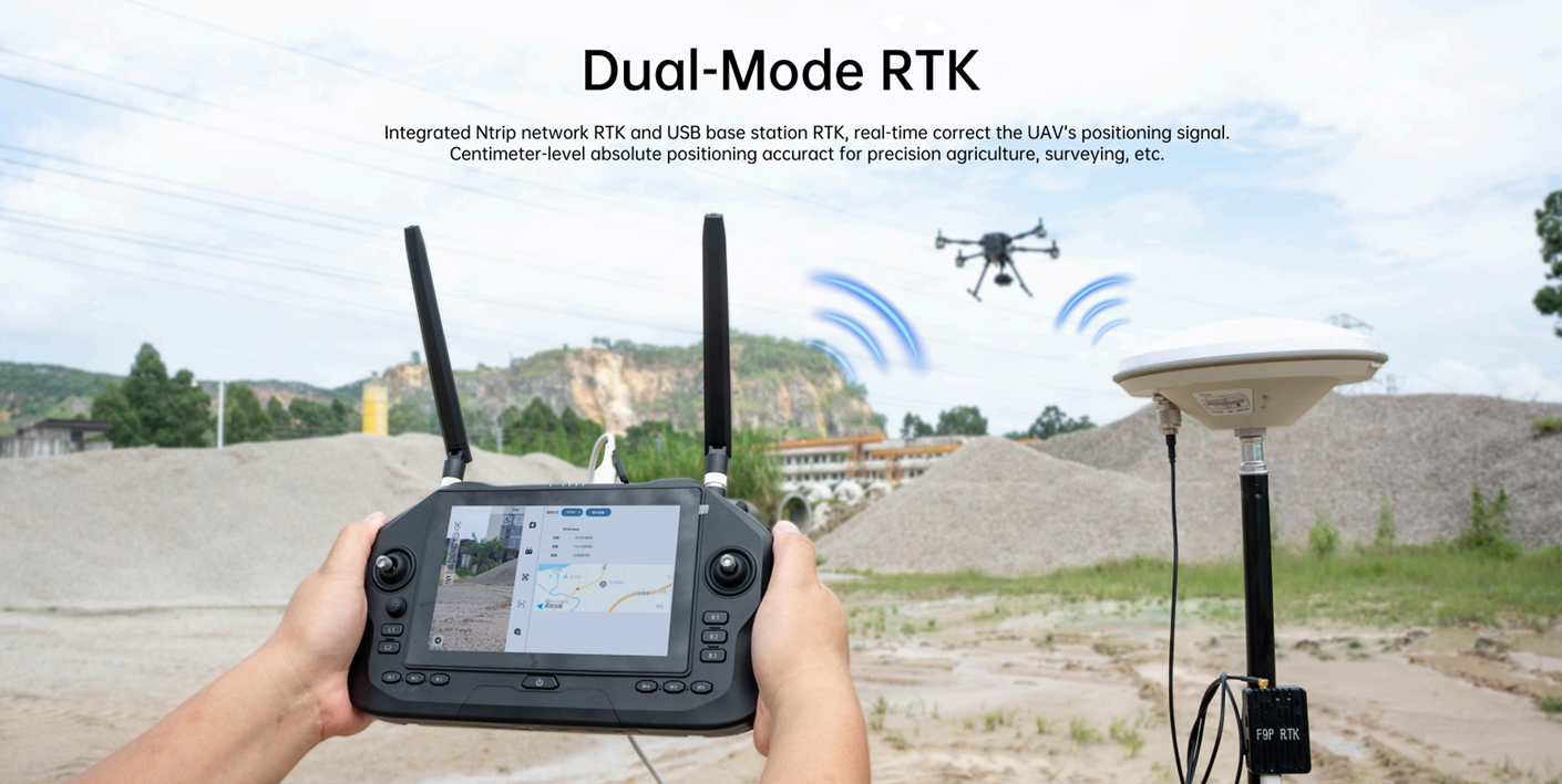
Integrates dual-mode RTK: Ntrip network RTK and USB base station RTK. Corrects the drone's positioning signal in real-time via a ground base station to achieve centimeter-level absolute positioning accuracy, meeting operational needs with millimeter-level error requirements like cadastral surveying and precision agriculture.
- Conventional RTK -
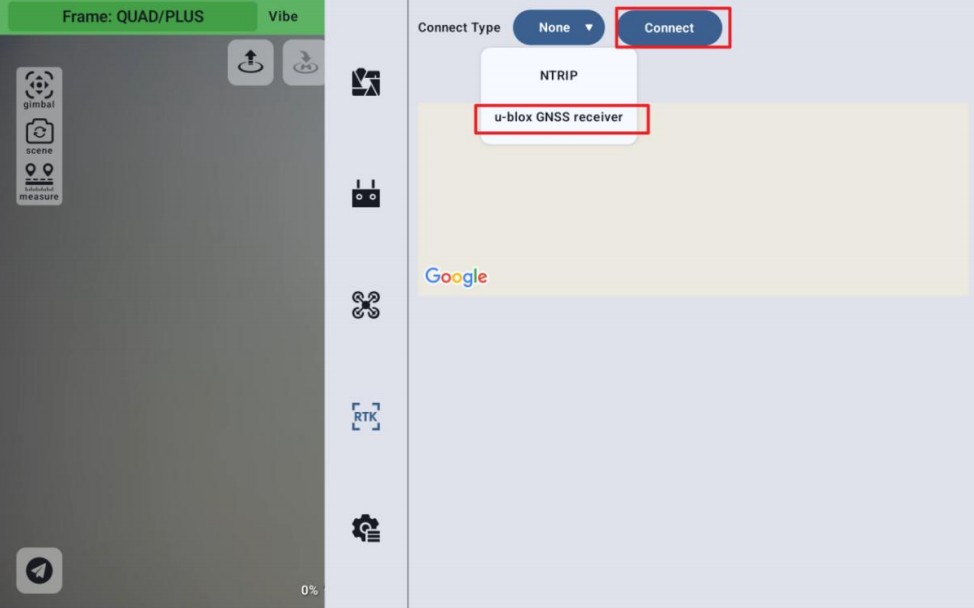
1. Connect the RTK base station to the USB port on the top of the remote controller using a USB cable.
2. Click "Connection Method". The application will automatically recognize and display the "u-blox GNSS receiver" option. Select this option.
3. Set the position accuracy and observation time as needed, then click "Connect" to complete the operation.
4. Wait until the GPS status in the top status bar displays "RTK FIX" to use the function normally.

- Network RTK -
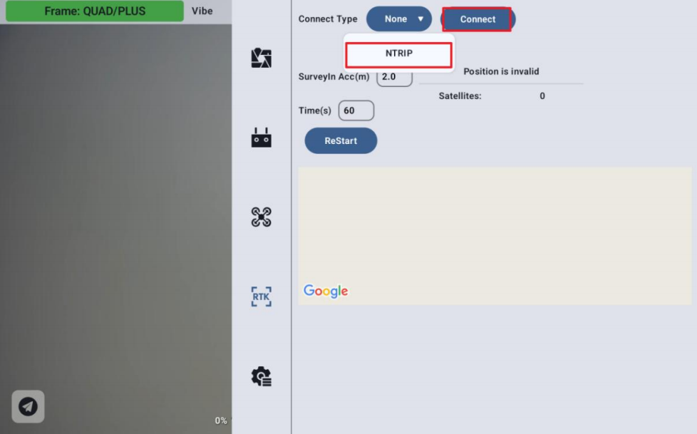
1. Ensure the device is connected to the internet. Select "NTRIP" in the "Connection Method".
2. Click "Connect", enter the NTRIP URL link, then click "Confirm".
3. Wait until the GPS status in the top status bar displays "RTK FIX" to use the function normally.
02. Oblique Photography Route
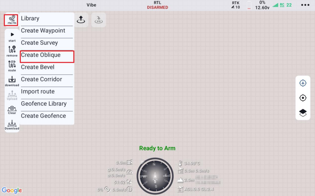
Automatically plans five sets of routes (one nadir route, four oblique routes in different directions) for overlapping flights, efficiently collecting 3D surface data. Suitable for urban modeling, engineering surveying, and terrain reconstruction.
1. Click the route planning button and select "Create Oblique Photography Route".
2. In the Oblique Photography Route tab, you can name the mission, select the camera, check resolution, set route altitude, speed, safe takeoff altitude, altitude mode, completion action, advanced settings, etc.
03. Corridor Route
Designed for long, linear areas (roads, rivers, pipelines) with parallel route sets, supporting automatic turn connections and full coverage scanning to improve efficiency in linear engineering surveys and linear map production.
1. Click the route planning button and select "Create Corridor Route".
2. In the Corridor Route tab, you can name the mission, select the camera, check resolution, set route altitude, speed, safe takeoff altitude, altitude mode, completion action, advanced settings, etc.

04. Bevel Route
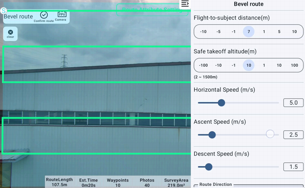
Routes designed for object surfaces (e.g., side walls, slopes). The flight path maintains an adaptive distance from the bevel, ensuring clear imaging of bevel details. Commonly used for slope monitoring and facade surveying. Only vertical facade routes are supported in the current version.
1. Click the route planning button and select the "Create Bevel Route" option.
2. Once a blank small window pops up at the bottom left of the interface, you can start route planning.
3. Unlock the drone per the usual procedure, manually control the drone to take off to a preset altitude, then click the photo button. The small window at the bottom right will update with the captured image. Land the drone and focus on subsequent route planning.
4. Distance data from the drone to the subject must be obtained before further planning the survey area and completing parameter settings.
5. In the Bevel Route tab, you can set various speeds, safe takeoff altitude, route direction, completion action, etc., for the mission.
05. Terrain-Following
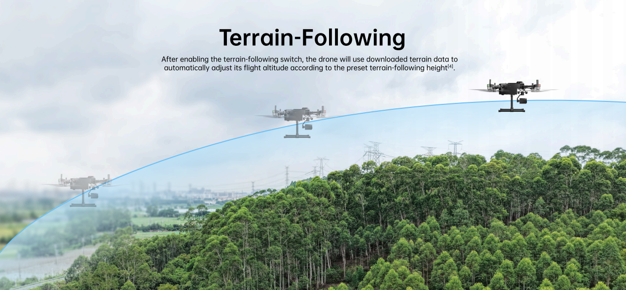
In all route parameter setting tabs, users can choose to turn the terrain-following function on/off. When enabled, the drone dynamically adjusts the route altitude based on DEM elevation data to follow terrain undulations, ensuring safety and model consistency for data collection in complex terrain like mountains and canyons.
06. Route Import/Export, Cloud Routes
UniGCS 2.0 supports importing routes in Waypoints format or files in KML format. Click the "Import Route" button and select the local Waypoints format route or KML format file.
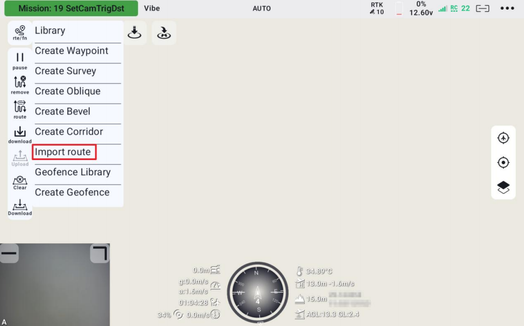
Waypoints Format Import: If you choose waypoints format file, it will be forced to converted into waypoint routes upon import.
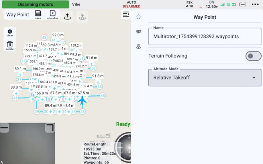
KML Format Import: After selecting the KML file, a prompt will appear. Please select the appropriate route type for import based on actual operational needs.
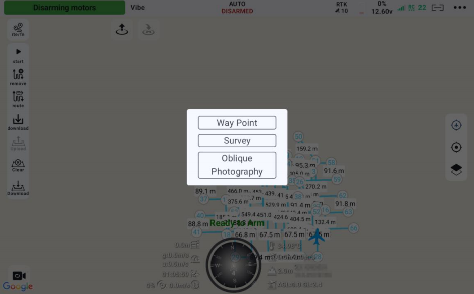
07. Route Information Estimation
Estimates route length, number of waypoints, flight time, number of photos, and survey area for the current route. Actual operations may deviate from estimates, it is recommended to add a 10%-20% redundancy buffer during actual operations to handle unforeseen circumstances.
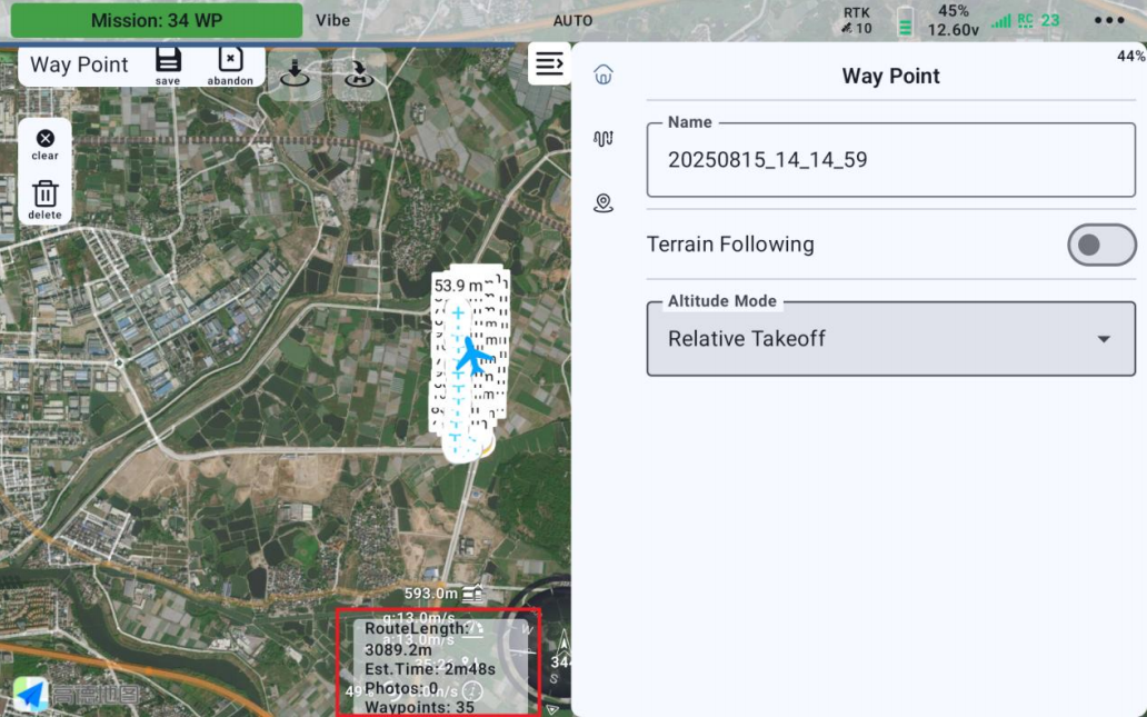
08. Route Progress Display
During a mission, a dynamic progress bar appears below the title bar, indicating the completed route percentage. The bar length increases as the mission progresses.
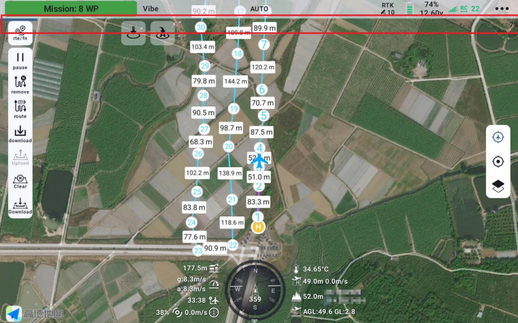
09. Voice Broadcast
Provides real-time audio alerts for critical flight statuses (low battery, arming, disarming) and flight information, reducing user visual monitoring load and enhancing safety monitoring and coordination efficiency on-site.
10. Resume Mission From Waypoint
After a drone mission is interrupted, the drone can continue the remaining route from the waypoint before the interruption point, without starting over from the beginning. Applicable to all route types except bevel routes.
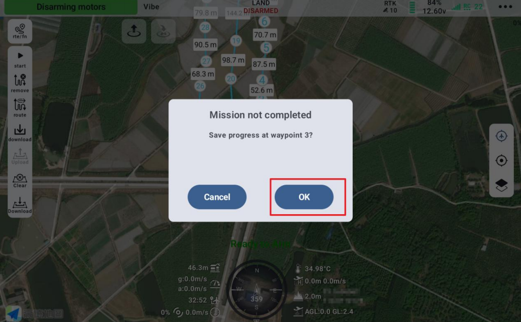
1. After a mission interruption, wait for the drone to return, land, and disarm. A prompt indicating an unfinished route mission will pop up on the main screen, click 'confirm'.
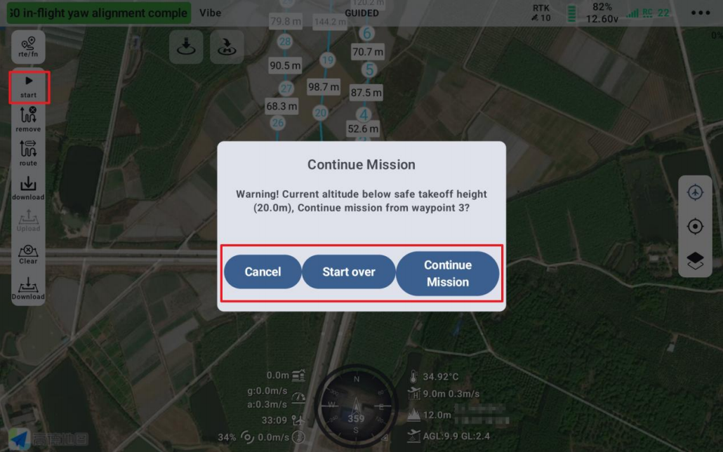
2. When the drone is ready again, please manually unlock the drone, lift it to a safe altitude, and click the "Start Mission" button. The system will pop up a "Continue Mission" dialog with options:
Cancel: Terminates the current auto mission. The drone stops executing the preset route.
Start Over: The drone restarts the full auto mission from the first waypoint.
Continue Mission: The drone continues the remaining route from the waypoint before the previous interruption point, ensuring mission continuity.
11. Point-to-Point Navigation
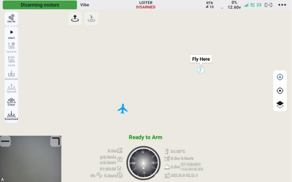
During flight, long-press any location on the map to pop up a "Fly To" window. Click the window, enter the specified altitude, click confirm, and the drone will fly from its current location to the target point.
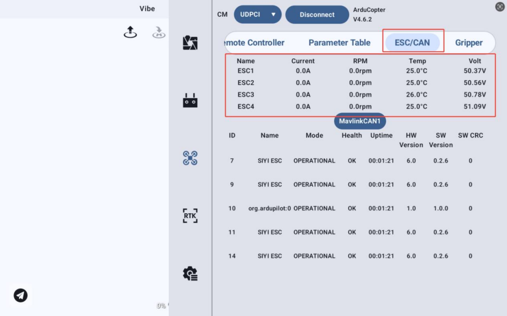
12. ESC/CAN Device Status Information Display
For ESCs with telemetry function, this page displays real-time current, voltage, temperature, and motor RPM for each ESC on the drone.
Get the Latest Software:
Chinese Download Link: https://siyi.biz/index.php?id=downloads3&asd=476
English Download Link: https://siyi.biz/en/index.php?id=downloads3&asd=476
Note:
1. MK15/MK32 require dedicated versions. Please visit the respective product download pages!
2. If UniGCS is already installed, the update will be pushed automatically upon opening the app, allowing direct download and update!
Best Regards.
Scan to follow the official account